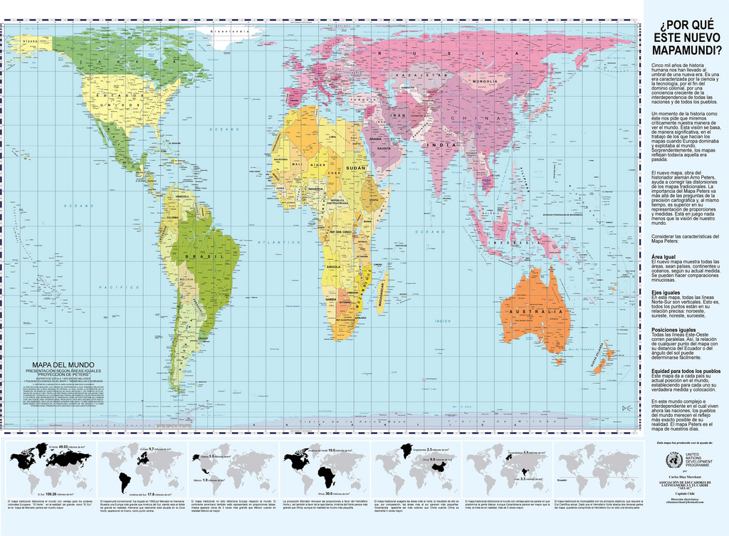
The earth is round. The challenge of any world map is to represent a round earth on a flat surface. We are so used to them that rarely we think about how precisely and realistically they represent the earth.
Today I want to talk about the Gall-Peters projection. This projection represents the earth in a proportionate way, unlike the Mercator projection, which is the one that we are used to. This video will help you understand a little better.
So after this brief introduction to this map projection you know that the most common map projection was made by a Flemish merchant and that is made to make naval navigation very easy, but that it does not represent the earth proportionally and some areas (especially the ones that are far from the equator are drawn bigger than they really are). This map projection is perfect for teaching geography in a way that the projection of the map doesn’t create any confusion on how “big” a continent or a country really is.
You can get more information about this kind of map: www.petersmap.com Also from the wikipedia (although is quite technical): Gall-Peters projection on Wikipedia